
Conferences and Releases
IBCSO Version 2 released
After 9 years of gathering, cleaning, processing and interpolating data, we are very excited to announce the release of IBCSO Version 2. Approximately 1,500 datasets from more than 20 countries and over 80 organizations were combined to produce the most accurate data driven map of the seafloor...
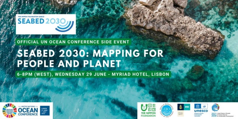
UN Ocean Conference Side Event: Seabed 2030 – Mapping for People and Planet, 29 June 2022
We are delighted to announce that Seabed 2030 will be hosting an Official Side Event at the upcoming UN Ocean Conference in Lisbon. We cordially invite you to join us for this high-level panel session to discuss the benefits of ocean mapping from a global perspective, and explore how mapping data...
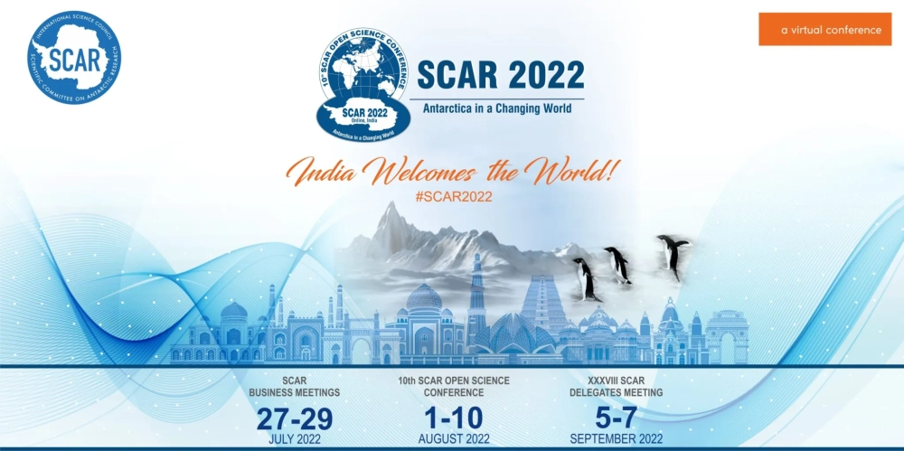
10th SCAR Open Science Conference in 2022!
The abstract submission for the 10th SCAR Open Science Conference is now open.Abstracts can be submitted electronically via the Abstract Submission Portal. There is no abstract submission fee. Before entering your abstract, you will be asked to choose a session. Take a look at the full list of...
18th IHO Hydrographic Commission on Antarctica (HCA) Conference
The conference will take place in Berlin, Germany from the 24-26 May 2022 and include HPWG and Region M ICCWG meetings. About this event The 18th Conference of the IHO Hydrographic Commission on Antarctica (HCA-18) will take place in Berlin, Germany, from 24 to 26 May 2022, in conjunction...
Fourth Seabed 2030 Arctic – Antarctic North Pacific Mapping
We invite you to participate in the Fourth Nippon Foundation-GEBCO Seabed 2030 Project Arctic-Antarctic and North Pacific Mapping Meeting About this event Dates: 21st to 24th March 2022 This meeting continues the series of mapping meetings organized and hosted by the Nippon Foundation-GEBCO-Seabed...
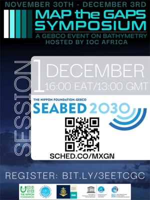
Map the Gaps Symposium
Map the Gaps convenes a global event on bathymetry on behalf of GEBCO. Topics such as mapping and data processing technology, deep water exploration, mapping missions, policy, diversity, equity & inclusion, Seabed 2030 and alumni activities are shared and discussed. Participants include...
IBCSO side meeting at XIII ISAES 2019
The IBCSO group will meet and present a poster on 23 July 2019 at XIII ISAES 2019. The International Bathymetric Chart of the Southern Ocean (IBCSO) is a collaborative effort to compile all available bathymetric information of the Southern Ocean. IBCSO Version 2 will cover the area up to 50° S....
IBCSO Poster at 2015 ISAES XXII available
A poster presentation on the status of the project was presented at XXII ISAES on 16 July 2015. The poster is available to view in pdf the SCAR Library (1.14 MB) .
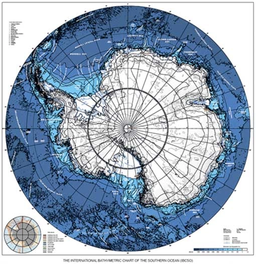
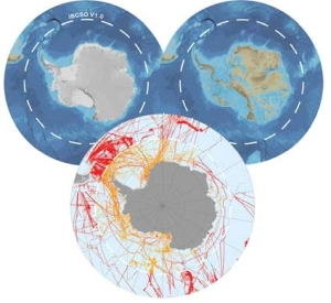
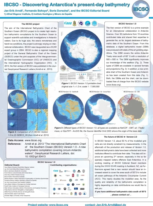
IBCSO version 1.0. released
The International Bathymetric Chart of the Southern Ocean (IBCSO) v1.0 has been released. The Release Paper has been published in the AGU journal of Geophysical Research Letters. Details on how to access the data are available on the IBCSO data page. The printed IBCSO map is available through the...