
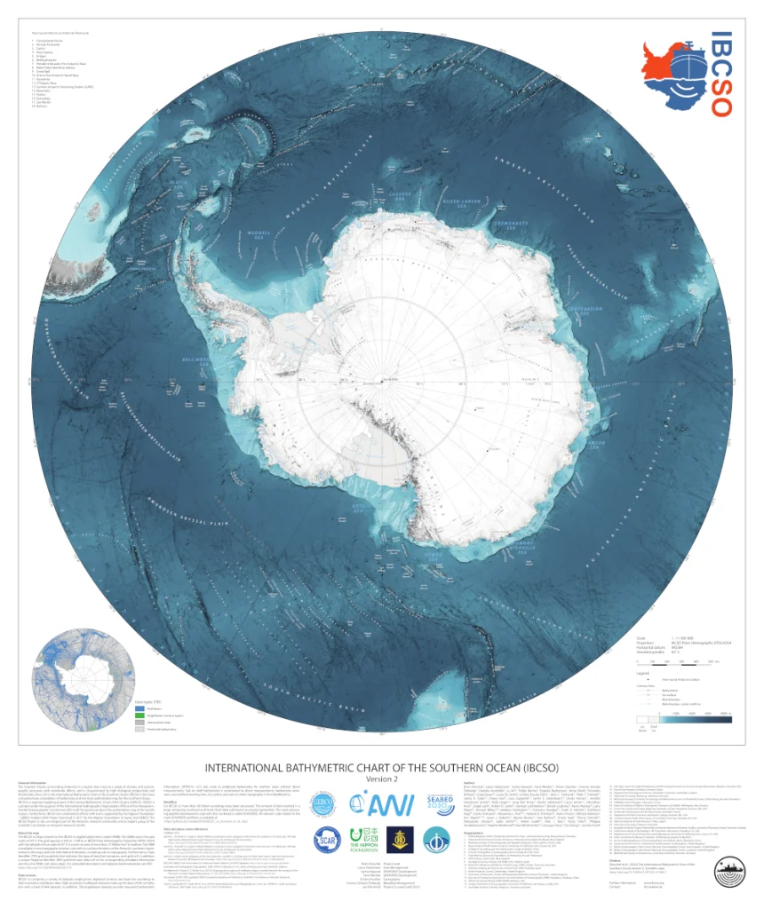
After 9 years of gathering, cleaning, processing and interpolating data, we are very excited to announce the release of IBCSO Version 2.
Approximately 1,500 datasets from more than 20 countries and over 80 organizations were combined to produce the most accurate data driven map of the seafloor south of 50°S yet.
IBCSO v2 now covers 48,450,304 km² of sea floor, driven by 11,454,506 km² of true data coverage at 500×500 meter resolution.
The accompanying publication has been released on June 7th 2022 in Nature Scientific Data:
Dorschel B, Hehemann L, Viquerat S, Warnke F, Dreutter S, Schulze Tenberge Y, Accetella D, An L, Barrios F, Bazhenova EA, Black J, Bohoyo F, Davey C, de Santis L, Escutia Dotti, Carlota Fremand AC, Fretwell PT, Gales JA, Gao J, Gasperini L, Greenbaum JS, Henderson Jencks J, Hogan KA, Hong JK, Jakobsson M, Jensen L, Kool J, Larin S, Larter RD, Leitchenkov GL, Loubrieu B, Mackay K, Mayer L, Millan R, Morlighem M, Navidad F, Nitsche FO, Purser A, Rebesco M, Rignot E, Roberts JL, Rovere M, Ryzhov I, Sauli C, Schmitt T, Silvano A, Smith JE, Snaith H, Tate AJ, Tinto K, Vandenbossche P, Weatherall P, Winterstellar P, Yang C, Zhang T, Arndt JE (2022): International Bathymetric Chart of the Southern Ocean Version 2 (IBCSO v2). doi: 10.1038/s41597-022-01366-7
For more information please see IBCSO current Version.