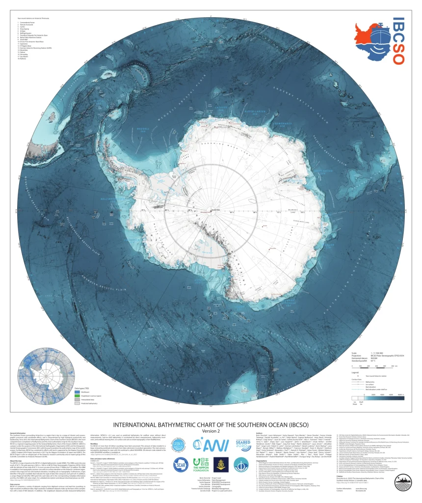
The objective of the International Bathymetric Chart of the Southern Ocean (IBCSO) is to gain better knowledge of seafloor topography in the Southern Ocean, which stretches from the southern tip of South America to the coastal waters of Antarctica. As the largest repository of bathymetry data in the Southern Ocean, IBCSO is the definitive source for scientists, cartographers, and others looking for a map of the seafloor. Due to the remote setting of the Southern Ocean much of the area remains unmapped or inaccessible and requires contributions from various institutes to continually improve its accuracy.
Over 80 institutions of more than 20 countries contribute data to help improve the product. The gridded product is then made available to the public at a 500m x 500m resolution in a polar stereographic projection and is also incorporated into the annual release of the General Bathymetric Chart of the Ocean (GEBCO). The first version of IBCSO was published in 2013 by Arndt, et al., covering an extent south of 60°S. IBCSO became associated with and is supported by the Nippon Foundation – GEBCO Seabed 2030 Project (Seabed 2030) since 2017.
IBCSO version 2 has been released in June 2022. The new grid covers 2.5 times more bathymetry area and is, due to the Seabed 2030 project, extended up to 50°S.
GEBCO is a project under the auspice of the International Hydrographic Organization (IHO) and the Intergovernmental Oceanographic Commission (IOC) of UNESCO. Furthermore, IBCSO is an Expert Group of the Scientific Committee on Antarctic Research (SCAR). For further information see the linked logos below.
Anyone who can provide bathymetry data of the Southern Ocean is welcome to contribute in order to fill gaps and improve the next IBCSO version.

